

Update: April 12, 2024
This webpage created Jan 1, 2009
What others are saying……
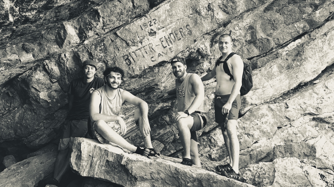
6/08/21 Bitter Enders Cave – I grew up camping at Turner Falls in the early 90s with my dad and ended up on many trips out there over the years with friends, family, and the Boy Scouts. I’d always known about several caves in the area, but became very interested in Bitter Enders Cave and the stories from decades ago. In the fall of 2017, after many days of research, I lead a group of friends up the creek to the source. It took us about half an hour to find the entrance and we were close to giving up. We explored the cave as far as the pool of water with the underwater passage. I had no intention of going under, but then noticed a very small gap in the water line at the ceiling that lead to the next chamber. After confirming with a flashlight, I dove under and came up on the other side. The next room had a lot of water and a small ledge to swim to. I was only there for a few minutes before I had to return to my friends, leaving the remainder unexplored. It was a great adventure and a highlight of my many trips to Turner Falls. Hoping that others in the future will continue to treat the land and the caves with respect. I appreciate you preserving the history of these caves with the pictures and testimonials. -Nick
Photo of Bitter Enders cave
1/11/21 Torture Cave – In 1933 my dad, Dean London, and his brother Ray, who were from Ringling, attended Camp Chapman, a long since abandoned Boy Scout camp on Deel Creek, about a mile upstream from where it empties into the Washita near Dougherty, Oklahoma. That year, the Scoutmaster took the troop into Torture Cave, located just off a side creek about a quarter mile from Camp. It may go by other names, but Dad said it was called Torture Cave due to the cold water which had to be waded or swum. After what seemed like a mile in the cave, it apparently ended at a circular pool surrounded by rock. The Scoutmaster dove into the pool, returning within a minute, saying that there was more cave on the other side, but he would not let the Scouts try it due to the danger. My Dad always wondered about that other side. When I was 12, he took me on an Arbuckle hike which included Torture cave, but we only went in a few feet because we had no lights. -Susie Harvey 50qusie50@gmail.com
07/23/13 RE: Torture Cave near Turner Falls:”Butch, yes, I’ve been to Torture Cave… several times in my youth… maybe 30 years ago. Really cool hike from Turner Falls (2 hours?). I remember the watercress patches and the freshwater springs bubbling up from the bedrock at different spots along the way, just off the main stream. I remember the main entrance to the cave, which was up a dry, rocky run-off area at the bottom of a cliff… which overlooked the main stream. Pretty easy hike through the cave, although very slow going due to the loose rock terrain, and slimy footing. Anyway, I remember it going on for quite a while… which I recall to be about a mile, just as you said. And then all of the sudden, the hike ends into a pool. The path just dead-ends into this pool, surrounded by rock walls and a ceiling. You can wade out into the pool, which gets progressively deeper with each step. You end up in about throat-deep water at the far wall, depending on recent rainfall levels of course. Now if you aren’t aware that there is an underwater passageway which takes you to the other side, that leads into another HUGE room that is incredibly kick-ass, then you would naturally just wade the hell out of the pool and turn around. But as you can recall, you were my first cave guide. And as you mentioned, in 1965 you discovered this passage to the other side. So as a scared 12 year old, I witnessed you dive down and disappear into the wall… Several minutes passed, and I remember thinking.. “either he knows what he’s talking about and he’s on the other side, OR… he’s met a watery grave… and we’ll have to somehow fish his body out”. Maybe 7 minutes passed, and then you emerged suddenly, back on our side. You determined (correctly) that this was too dangerous for your wife (my mom) and the 12 years olds in our group, and so we back-tracked it out of there. But then you remembered there was another entrance, which was quite different than the one we took initially. After about a 30 minute hike up and around the cliff side that overlooks the main entrance, you found the other entrance on the back side. We were clearly high up on a rocky cliff (it may qualify as a mountain), and this entrance amounted to a small hole in the ground, which was about the size of a manhole in the street. We had to fix ropes and rappel down this entry, one at a time. It was about a 30 foot rappel, down to the bottom of this huge room. It was surreal, like something out of a dream. At the back of the room, the main water source came up from below ground and appeared as a canal out of nowhere, and went to the pool with the underwater passageway, which leads to other side…. and back out to the main entrance. Anyway, the water in the canal in this huge room is pretty deep…. definitely over your head. Although rope-assisted, the climb back out of this natural cavern is not easy (at least for a young city slicker). I always knew this cave as being called “Bitter Ender”. It’s not on any map I’ve seen, and as far as I know, it’s a pretty limited group of people that are even aware this thing exists. I think it’s on some rancher’s private land, which could mean trespassing charges if you happen to be seen. But I guess that might add to the appeal? Although it’s plenty sweet on it’s own, with no shortage of adrenaline moments. And I forgot to mention the blind, albino salamanders and fish that live in the pools. Cool stuff. “ -Jim Hakes jhakes@flcb.com
——————————————–
11/29/12 “Butch, I happened upon your website while trying to show my 94-year-old father some photos of the Arbuckles on my iPad. I’d like to add my account of what happened at Torture Cave in 1933 and 1965.
In 1933 my dad, Dean London, and his brother Ray, who were from Ringling, attended Camp Chapman, a long since abandoned Boy Scout camp on Deel Creek, about a mile upstream from where it empties into the Washita near Dougherty, OK. That year, the Scoutmaster took the troop into Torture Cave, located just off a side creek about a quarter mile from Camp. It may go by other names, but Dad said it was called Torture due to the cold water which had to be waded or swum. After what seemed like a mile in the cave, it apparently ended at a circular pool surrounded by rock. The Scoutmaster dove into the pool, returning within a minute, saying that there was more cave on the other side, but he would not let the Scouts try it due to the danger. My Dad always wondered about that other side. When I was 12, he took me on an Arbuckle hike which included Torture, but we only went in a few feet because we had no lights.
In 1965, when I was 19, I took a college buddy from OU to explore Torture. READERS—DO NOT DO WHAT WE DID!!! We told no one where we were going, and our spelunking equipment was 2 el-cheapo flashlights with plastic wrap held with rubber bands. We followed the cave, which fortunately had no side passages, for about a mile, then reached the circular pool. We found carvings on the rock there, including R.N.L. 1933. My uncle was Ray Neal London, so we figured we were at the right place. After much debating, I lost at rock-paper-scissors and so went first. After 20 to 30 seconds, I was about to turn around when I felt an air pocket. I came up in a huge cavern which went as far as my light would shine. I forgot to signal my friend, so suddenly he appeared, not too happy with me. We started into the new passage, and after about 50 yards my light started flickering. We made a hasty retreat, and about halfway back to the entrance, my friend’s light started flickering. We made record time from that point, and the faint light from the entrance was a welcome sight indeed. We made it out with one light out and the other flickering. I still thank the Lord for protecting us from our folly.
I’d like to hear from anyone who has been to this cave, by whatever name, especially regarding how far the cave went on past the circular pool. Also, please say if you remember old Camp Chapman, which I think was abandoned in the 1940s. Thanks for the stories and for letting me share mine.” -Bruce London bruceleelondon@yahoo.com
Sulphur youth disappears in “Torture Cave” 1938
1938 newspaper clipping from The O’Collegian at Stillwater, Oklahoma
——————————————–
09/14/11 “I know some about Wild Woman Cave and Bitter Enders Cave. I worked on a mapping project at Wild Woman Cave and made over a dozen trips back in 1984 – 1985. One thing I can tell you for sure and that is you don’t want to be in Wild Woman Cave when it rains!” -Jerry Pate
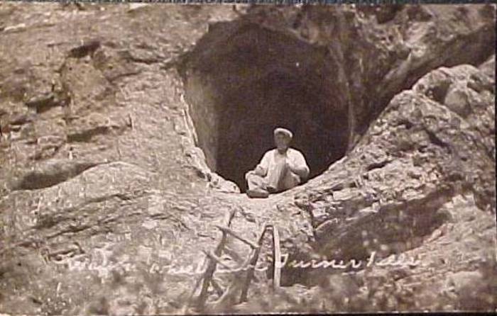
This is a photo of Bitter Enders entrance after a 15 minute downpour
——————————————–
06/16/10 “Butch, I grew up in Whitebead, Oklahoma, near Pauls Valley. Back in the late 60’s and early 70’s my friends and I explored most of the caves in the Turner Falls area including Wild Woman, Bitter Enders, Wagon Wheel, Crystal, Raccoon and others that do not have names. We mapped Wild Woman and Bitter-Enders. We also conducted an ecological study of Bitter-Enders including water analysis and atmospheric gas analysis. The hardest part of the study was hauling all of the equipment to the site. We were also the first and maybe the only group to reach the bottom of “The Bottomless Pit” in Raccoon Cave back in 1970. Boy Scouts camping at Doc’s Blue Hole, near Raccoon cave, had attempted the vertical drop since the mid-30’s including my late uncle. These stories over time caused the bottomless pit to get deeper and deeper, plus the fact that the walls and ledges of the pit are covered with mud, when you drop in a stone in an attempt to approximate the depth, the stones hit the soft mud and you never hear them hit. For the record the Bottomless Pit is 172 feet deep. On one expedition we spent two days underground exploring Wild Woman to develop the maps. Other large caves are located near Dougherty, OK. Including one that had an entrance large enough to ride horseback into the cave for several hundred feet. This cave is so complex that some boy scouts from a nearby camp got lost in the cave. An expedition took several days to find the scouts alive and well. The original entrance was dynamited back in the 1940’s to prevent further possible accidents. Some further information regarding Wild Woman: Ethel Hindman was in Oklahoma in the 1930’s and performed a stunt, jumping from the wings of a bi-plane into the lake, during the dedication of Wiley Post Lake near Maysville. Mr. Patterson, the original owner of the ranch, was at the dedication and hired Ethel to come down to his ranch. The original entrance was a sink hole filled with water. Mr. Patterson knew that the entrance to the cave was under the water and Ethel dove into the water and came up inside the cave. She was hired to explore the cave to find a source of water. The ranchers used the information to drill into the cave from the surface to supply water to their cattle during the drought, “Dust Bowl” of the 1930’s When you look at a the name is painted in blue. The original color was an extremely faded yellow. On one expedition I carried along a brush and a tube of blue acrylic paint and copied over the original to preserve the lettering. This is a very good paint as it has lasted since 1969.”
Denver Kimberlin
Coweta, Oklahoma
——————————————–
08/19/09 “I thought it may be forthcoming to clarify lingering assumptions regarding Wild Woman Cave and Bitter Enders Cave. Subsequently they both share a division of a larger interconnecting system. Therefore Bitter Enders Cave occupies the lower southwestern entrance adjacent to honey creek. This entrance abruptly ends due to impassable slump. Hence the derived name for “Bitter Enders Cave” form a group of hiker in the 1920’s. Several other entrances do exist however all they all pose challenges. Trace dye tests have been established and evidence of dye has been recorded in several springs in and around the area.
In the early 80’s or late 70’s the cave claimed 2 people’s lives. Cave divers entered the cave with a common goal to extend surveys and locate new connecting passages. Due to unknown reasons, they drown. This resulted in the 2 deaths. Unfortunately, this ignited a heated controversy and sequence of legal actions against the land owners on behalf of the bereaved family members. Since this time, attempts to access Bitter Enders Cave or Wild Woman Cave has been strictly prohibited. Bitter Enders Cave and Wild Woman Cave have been survey by several professional caving teams over the past 2 decades. This system is one of the largest known cave systems in South Central Oklahoma.” -Paul M. Rowan, Denton, Texas
——————————————–
08/13/09 “Hello Butch, I’ve really enjoyed reading all your stories regarding Oklahoma’s rich history and your experiences in and around the Arbuckle’s area. I wanted to provide my own accounts with Bitter Ender’s Cave for your readers to sooth their curiosity.
Since the 80’s my best friend, Jesse Zimmerman and I have been intrigued by this area as many others have been inspired over the past decades. There is a vast network of caves and springs emerging west and east of Turner Falls.
Unfortunately there have been many alternations implied by the City of Davis to Turner Falls Park. This has resulted with some very negative environmental impact to the park and the honey creek water shed area. During the 90’s a forest fire scorched 1000 + acres. The park and surrounding area was heavily affected from the burn. This was attributed by an unattended fire and pure carelessness. Located on the (backside) or, southwestern end of the park, honey creek resembles a rubbish depository due to careless visitors who throw trash, cans and plates into the water. This is disgrace and reflection on behalf of the park management and their continued negligence. In comparison to the yesterday years, the park now evokes a broader picture to the delicate balance and future of honey creeks and Turner Falls. The creek has been altered by several improvised man-mad damns and park expansion. This is not an ecosustainable solution. I’m disappointed to see such derogation to this beautiful gem in the Arbuckle’s. I can only hope that the state of Oklahoma will preserve its ecology for future generations, just as the native Americas have done centuries before we arrived.
Over the years, I’ve maintained vivid memories from the first time I visited Turner Falls and this amazing grotto. This unique place, wedged somewhere between the deadwood, and tall switch grass inside a marbled canyon. Our journey was inspired by an unorthodox assumption that there was a cave located at the end of honey creek? It only seemed natural considering all the other springs and caves in the area.
Jesse and I have always maintained open ideas in adventures. Therefore we’ve never been detoured by our one tracked minded objectives in taming the wilderness. Both growing up in Denton, Texas and spending years exploring the surrounding countryside, we grew very fond of Southern Oklahoma. One summer day while camping in turner falls, we realized the park alluded to many secrets. We were determined to uncover them single handily in secrecy. We choose a higher route through junipers and over the rocky prairies to take a more direct approach, “over the hill assault”. We had no ideas as per what to expect, nonetheless we were determined. It was a hellish hike, and by the time we arrived to a resting place, the heat and land had, had its way with us “Arbuckle style”. We were sliced from being whipped by brier vines. It was a long trek that exhausted 3 hours (one-way). Upon arrival we additionally realized that we were covered with hundreds of seed ticks from heads to toe. We headed for the creek to rinse and cool off from our invigoration. As we migrated down hill exploring a ravine, we discovered Bitter Ender’s Cave while taking a water break in route to the stream. The discovery of the cave was by sheer accident. At this point we knew nothing of its existence. After all, this was the age before the Internet and we were fueled only by speculative intuition. We cooled off in honey creek first and reminisced over the endless possibilities of what lays ahead our path?
On our second trip, we had grown wiser from our experiences and decided to hike along the stream bed to stay cooler and to avoid ticks. The stream revels a more picturesque setting. The creek meanders though a canopy of trees, rock outcroppings and cascading pools framed by moss. Since this time we both have frequented the area several times.
The creek-side trek takes about 2 1/2 hours each way. This is an aggressive day hike, designed for the advanced hiker. Wear excellent shoes, bring a day pack with provisions and carry walking staff. We always wore Teva’s or Chaco sandals, they were most suitable on the feet. The trip duration will occupy 8 + hours. Also take in account, that undertaking this journey means that your trespassing on private property, therefore you need to get permission first.
There are many cave systems located in the Arbuckle Simpson Aquifer region. Bitter Ender’s Cave is one of them; the cave is located approximately 5 and half miles southwest of Turner Falls, OK along honey creek. Upstream, there is a spring that feeds honey creek. The spring is located approximately 50 to 75 yards upstream from the cave entrance, adjacent to a rocky stream bed. The spring water is delightfully pristine and cool. This area is the aquifer recharge zone and serves as the main headwaters for honey creek. There are additional spring tributaries that branch off along honey creek west of Tuner Falls. The lower creek side entrance of Bitter Enders Cave is covered by a rock overhang. The cave opening is approximately 6 to 8 feet in height and 12 to 14 feet in width with downward incline of 18% 20 degrees leading into the cave. Depending on the season, the lower sections of the cave can be filled completely with water as per the water table is higher in winter and spring months. At times the cave discharges water from its creek side entrance and it can be a torrent. The cave interior channels offer a couple of rooms you can stand up in. The rooms are obscured by a large bolder in the passage. There are very little formations in this cave due to rapid changes in water levels. A subterranean stream can be heard, and flows beneath a small natural bridge leading into a lower chamber. The underground stream inside the cave is also directly related to the springs that are discharged in and around honey creek. Once inside the second lower chamber, the room meets a small clear a pool, or “slump”. The pool is framed by an impassable wall. This it the termination point of the cave, “end-of-the-line” unless you are an expert in advanced cave diving. Bitter Ender’s Cave is a small delicate grotto from the creek side entrance. There are several other known entrances, however the lower creek side entrance and its subterranean passages are only about 35 to 40 yards in total length.
*Essential Caving Notes*
If you’re inclined to venture into caves, do so at your own risk. Always travel with more than one person. Obtain permission from the land owners first, preserve the surrounding environment and respect the delicate cave ecosystem, (avoid touching formations). Prior to departure inform a friend or relative about your destination plans, provide the location and time duration. Wear proper clothing; carry proper equipment, food provisions and 4 light sources with extra backup batteries and light bulbs. (Keep all of these things in plastic zip lock bag or (water proof dry bag). You will need to be in good physical condition too. Never enter caves systems after recent rains, unless you know exactly what you’re doing, or this may result in your own demise. Be safe and good luck and respect the cave!” -Paul M. Rowan, from Denton, TX
——————————————–
03/09/09 “Butch, this picture of McGalliard Cave was taken sometime in the late 60’s or early 70’s. As I recall, Mac was coming back to Ardmore via helicopter when he spotted the cave in the Arbuckle’s, east of I-35. He put together this team to hike to the spot and name the cave. The men, left to right, are: Charles Smith, Glenn Smith, Ollie Testerman (I think), Woody (I don’t remember other name), V.S. Watson (I think), Mac McGalliard, and I don’t remember the man’s name behind Mac McGalliard. Joyce Franks was the photographer. Charles Smith, Glenn Smith, Woody, V.S. Watson, and Ollie Testerman; were all educators in Ardmore and Springer. Joyce gave each of us a copy of the picture.” -Charles Smith McGalliard Cave Photo
——————————————–
02/17/09 “With all the interest in the caves in this area, there is one I have not seen mentioned in the T&T. It is locally know as “Mystic Cave”. It is located on “Rock Prairie”.. two or three miles East of the old community of Nebo and Hwy 177. This property is now owned by the Mahard Egg Company and they do not welcome visitors. As a young men, my close friend Bill McGiboney and I visited the cave several times. The McGiboney farm was on Oil Creek about 1/2 mile S.E. of the old Nebo store, so Bill knew that area very well. The entrance to the cave was at just a hole in a little knoll of rocks and brush.
At one time there was a chain ladder leading down to the floor of the one small room. A small stream flowed thru this room and into a hole in what I would call the South wall of the cave. The hole was large enough for a person to enter but Bill & I never had the necessary gear to go any further. (Nor did we want to .) Legend has it that spelunkers entered the hole and explored down stream. How far, I don’t know. It is said that in one room, there was a steel pipe which came thru the top of the room and extended into the water ad ended just short of the bottom of the stream. It was to a windmill on the surface. On one of our visits, I was wearing an old US Army field jacket and the big side pockets were full of oats. (not oatmeal but oats as they grow, in the husk.”) I put the oats into the stream. We later found some of the oats floating in “Blue Springs” and also in “Buck Irwin Springs.” Both springs are on Chapman Ranch property near the twin silos. The water flowing from Blue Springs goes into Oil Creek on McGiboney property. Oil creek starts several miles north and is a small, weak stream until the Blue Springs and several other springs flow into it. It is an excellent fishing stream. Lots of Bass, “Goggle Eye” and Bream.” -Bill Uhles
——————————————–
02/15/09 “Butch, there seems to be some debate about the location of wild woman cave. it is located approximately 8 miles NW of Springer in the W 1/2 SW 1/4 NW 1/4 SW 1/4 of Sect 32 Range 1 East Township 2 South of Murray county. Most USGS maps show the cave. It is as described some of the passages are 2 ft tall to 25 feet tall and very wet.”
——————————————–
02/07/09 “Butch, We explored a cave the old timers at Gene Autry called Dead Man’s Cave. If I remember it was about two or three miles west of Buck Hale’s house on Buck Hale Road (Lumbermans Road), turn north about 1 mile. There is an old military shooting range you go by, there was a ranch road we walked to the top of the mountain, the cave is on the very top of the hill, it goes down about twenty feet to a small room.” -Jerry Williams
02/07/09 “Butch, I remembered two more caves, one is on the mountain overlooking the railroad bridge where the river comes out of the mountains it is about 30 feet down the west side its hard to find there is a little outcrop of rocks that is really the only hint of the cave it goes almost straight down, I think Louis Hope and some others went down on ropes. I was by myself when I found it so I didn’t even try to enter it. The other one is south of the river bridge west of Dougherty, there is an old scout camp about a half mile south of the bridge, the cave is just south of the camp, there is a large outcrop of rocks in front of it so it was pretty easy to find. It goes down a few feet and back into the hill there was water in it so we didn’t go very far into it.” -Jerry Williams
——————————————–
02/06/09 “Butch, We explored a cave the old timers at Gene Autry called Dead Man’s Cave. If I remember it was about two or three miles west of Buck Hale’s house on Buck Hale Road (Lumbermans Road), turn north about 1 mile. There is an old military shooting range you go by, there was a ranch road we walked to the top of the mountain, the cave is on the very top of the hill, it goes down about twenty feet to a small room.” -Jerry Williams
——————————————–
02/05/09 “Butch, The cave they are talking about (Dead Man’s Cave) is located on Noble’s place east of Springer. Glenn Shirley wrote a good article about this incident. It was titled “We ought to have the bones of the woman”. It was published in the March 1991 issue of True West. He listed the desperado as Martin Joseph, generally known as “Bully”, the other was named Henry Loftus. The man they murdered was Bud Stephens and the woman was a girl only named as Ella. Joseph was hung on June 29,1883 in Ft. Smith. It is a good article and has some pictures and illustrations.” -Tom
——————————————–
01/24/09 “I have been following your “Turner Falls Caves”, and have been in a couple of them and find some interesting replies about the Methodist Boy Scouts, and Linder et. al. There is a rather prolific creek five or six miles SE of this area that reportedly outcrops through a cave system in these mountains, known as Oil Creek (falls). There is a very nice lake on the Goddard ranch on Oil Creek and it gets its name as a wagon stop to grease wagon axels during IT days, The lake is formed from a dam and its spillway when running is a nice waterfalls back into the original channel. I have heard this creek emanates from a cave that has been explored by some of the Goddard Family, and I’m sure you would need permission to try to find it. There may be some of your Readers that have been in this system which is topical to your Southern Oklahoma interests.
I have spelunked with some from Odessa Texas in some of the San Andres formation that Carlsbad Caverns is in, and Cotton Wood Cave (On USGS Maps is outside the Carlsbad Caverns Park area, and begins at a higher elevation. There are several entrances in this Cavern system but the main entrances faces east, is rather wide, greater than 100 Ft. and a high opening with spectacular columns, stalactites and stalagmites just inside the entrance. The cave is dry at this point, but steeply dips westward in soft dust that you sink into to your knees. Towards the end of the first room the going is easier and one finds a crevice along the south, left, side to go into a small room, edge along the crevice into another small room and a ceiling hole that can be climbed into an adjacent huge room, at which point one finds a large coffee can containing a notebook where you can date and sign in when you were there. We descended further into the cave until it became wet , and the deposits were wet and very interesting. At the water table, the cave became underwater and there was an anchor cable that had been extended parts unknown for our group. Five guys in a sedan. The interesting part we were able to drive to within 500 yards of the entrance near a forest tower, but we had to clear large rocks off the road to get the sedan there. We took a road North of Carlsbad to circle up on the higher plateau, then head south into the area just west of Carlsbad Caverns. This was not a boy scout camp trip, but we went into the cave about 3 PM and exited dog tired about 9 pm, , pulled out the sleeping bags and crashed on hard rocks. That night a cold front moved through, and we were the stiffest and aching bunch of oilfield desk jockeys.
The cave systems in the San Andres formation reefs, (That’s the El Capitan area, highest point in Texas,) Geologically the reef system circles from this point our under the plains North of Carlsbad towards Texas then bows southward and is underground near Wink and continues. The formation contained some oil fields there, and has been used as a water supply for water floods on the Central Basin Platform that runs from North of Lubbock, to Odessa South. To Crane and I think to Ira Ann, Texas, famous Yates Field.
Back to the El Capitan Area, I made several exploratory trips there, Met the ranch foreman for the Hunter Ranch, Mr. Kincade for permission to climb Guadalupe Peak, which was granted. This was before the Ranch was made into a park. McKittrick. I was with a young Odessa Fire Chief, Rags Ragsdale, both radio amateurs. We had as a goal to set up a higher elevation amateur radio station to work 2 Meters back into Texas, mostly with converted surplus radio gear. We didn’t get too far. Instead we had an invitation from the FAA operators at Salt Flat to set up in the beacon house at Guadeloupe Pass, which we did and were sufficiently rewarded. Several tales about this trip that includes Elk Tacos, Mule Eared Deer, 29 Aircraft Crash Sites to visit (we made one), Covered with rattlesnakes. Globe Swift.
If you get a chance, see if anyone has been in Arbuckle Caves on Oil Creek.. I communicate some with Johnnie Joe Day, Mike Eakin, Gary Heartsill , Billy Bow, but have not located many of the Explorer Post guys that met at the Christian Church on Thursdays. A lot of stories, no more time.” -Jim Renfro
——————————————–
01/18/09 “A friend just told me about your website and newsletter. I have been reading your information about Turner Falls area caves with great interest. You see, a few scouts from my son’s Boy Scout Troop 5 visited Wild Woman Cave just last Saturday. It was a fascinating experience for them, and my husband took some wonderful photos while inside the cave. I know that the cave is on private property and that the owners want to keep it private and protected. It is definitely not a cave that can or should be open to the public. As some of your readers have already reported, just getting down into the cave is difficult, and maneuvering around inside the cave is pretty challenging. Even after exploring for about 3 hours, the group hadn’t seen it all. I might add that the Boy Scouts and their leaders had 2 guides to lead them through.
You can see from the first photo of just how difficult it is getting into Wild Woman Cave. They had to shimmy down a narrow opening, then drop down a shaft, then go through another narrow opening then down another shaft. One of the guides said there was another entrance somewhere, but they never could find it while they were in the cave. Evidently, it’s even more treacherous, because from that opening it’s about a 30 ft drop to the cave floor below.
The first photo is hazy because the camera lens fogged up due to the rapid change in temperature. It was about 40 degrees outside compared to about 70 degrees inside the cave. Also, notice the small passages where they had to crawl on hands and knees. They definitely got a work-out! But there were some large and very beautiful rooms, as you can see in the photos. It was quite an experience and one they won’t soon forget!” -Tonya Dees
Photo 1 Photo 2 Photo 3 Photo 4 Photo 5 Photo 6 Photo 7
Photo 8 Photo 9 Photo 10 Photo 11
——————————————–
01/02/09 “Wild Woman cave is east of Nebo about 3 miles. Wagon Wheel Cave is south of the pool below turner falls about 1/4 mile and a climb up about 75 ft. It is a large opening about 7ft in almost a perfect circle, thus the name wagon wheel. Bitter Enders is a cave I don’t know anything about, but…. the cave where all the water comes down Honey creek and over the falls is the one I spent a lot of time in. One of the descriptions a fella wrote about going down into mud and sliding down and down until you hit the water. It was ice cold and we had to use old small inner tubes that we blew up by mouth to float down to the room where the water went under the ledge and outside. You could see the outside light coming from under the water. It may be called Bitter Enders but I never knew the name of it. It is about 3 to 4 miles due West of the falls and the water comes out from under a large ledge. Opening is couple of hundred feed west of that. Straight down for at least 60 ft, then the steep mud slope into the water. The mud slope is about 50 to 60 ft long at about a 30 to 40 degree angle. Went back into that cave in late 60’s after they built the freeway and a rock the size of a small house had come down from the roof. Probably due to all the dynamiting for the highway. Swore I’d never go into it again. Killed a trophy sized coon tail rattler with a rock and took him back and park service came to the house and skinned him and he was on display in the nature center for several years. It was lying at the entrance to the cave “Bitter Enders” and I almost got nailed by him.” -Larry Ogwin
——————————————–
11/13/08 “While in college around 1969, three friends and I entered the Wild Woman Cave. I will only say it is in the Arbuckle Mountains because it is a fragile environment. As a child, I lived in El Paso (1954) with my Dad and we visited Carlsbad Caverns in New Mexico. The Wild Woman Cave (WWC) is not anywhere near as spectacular as Carlsbad, but it was an adventure one spring day for four guys from Ardmore. One of my three friends was a geology student at OU and he had the USGS map showing us where the WWC was.
As a dot on a small map, it was very difficult to find. We hiked several miles across the rocks of the Arbuckle terrain, which even as a young man was exhausting. We drank all our water on the way into the site and on the way out and at the end of a long day, we drank creek water. The first member of our team found a deep hole where we thought the cave entrance was and he entered it. It was straight down and could have been very dangerous had he entered the cavern from the top of a chamber. I watch as he went down a vertical shaft. At the moment he was almost out of sight, a second member found another entrance. It had a semi-secured entry placed there by the Ardmore Spelunkers Club (ASC). One of my teachers in Ardmore had mentioned his membership and adventures in the cave.
Removing some rocks, we entered an 18 inch hole passing first spiders, then past sleeping bats a few inches from our faces. We climbed down a wooden ladder placed there by the ASC. The tight hole delivered us into a larger main shaft covered by mud, running water, dampness, low temperatures and an occasional flying bat. Of the four of us with four flashlights, two flashlights went out immediately. I assume because of the dampness. The four of us descended a quarter mile on a slow decline, which included several tight spaces under rocks and through water. The lead friend had one of the flashlights and the rear friend had the other. Only very thin, agile and in excellent shape people should enter an unexplored cave. It was almost impossible to move because of the fragile stalactites and stalagmites. We took every precaution not to damage them. After encountering a partly flooded passage, we retreated to move up the cavern toward the entry and the first three friends actually missed our entry point. The last friend with one flashlight noticed the pile of rocks we had left in the middle of the shaft to show us the way out. Had he missed it I think we would still be in that cave. As we exited the cave we were covered with mud, sweat and cold cave water, so the warm spring sunlight felt very good.
I always wanted to take my boys to the Wild Woman Cave, but at my age I’m not sure I could make it. It is not a Carlsbad Cavern or an Oregon Cave which I visited in 1972 that could be commercialized. It is there for all time but not for all people. There is a good reason it is not commercialized. I hope one of the rock excavators doesn’t destroy it like so much of the Arbuckle Mountains or Arbuckle Quarry Holes as it will someday be called.” -Dan Mahoney
——————————————–
11/20/08 “Butch, When someone brought up the subject about Wild Woman Cave near Turner Falls, it brought back fond memories of one of my good friends of many, many years ago when I was still living in Ardmore. We attended church together and he was a fellow principal at Lincoln Elementary School. He was V. S. Watson, a spelunker as a hobby, with two other men on the team, whose names I can’t recall at the time. V.S. passed away many years ago but I’m sure some of your readers will remember him. They traveled all around the country exploring, charting and taking pictures of caves during the summer time. He spoke a good bit about Wild Woman Cave and they were deep within that cave more than once. He described it pretty much like one of your readers as muddy in areas and having to go through water at times to get to other parts. I also remember him saying that some of the passage ways were rather small to crawl through but once you got to the other side there would be large, beautiful rooms. Even at that time he didn’t believe it would ever be very commercial because of the difficulty getting through from room to room. He said man could probably improve to approach and entrance but the big problem was inside. His impression was: that it was as attractive as some of the popular caves once inside but just not suited for passage to the public. I have no idea what may have happened to their charts and pictures since V. S. and his wife, Erma, had no children. Some of your readers may recall and know who the other men on the team were. Just a bit of information to add to what has already been said.” -Edgar Wallace
——————————————–
10/30/08 “If you walked the 2 or 3 miles up to the source of Honey Creek, you were at “Wild Woman Cave” entrance (or exit). There is at least one other entrance up above the spot where the spring comes out of the rocks. There are at least 2 more caves on Honey Creek and 2 more located to the south of the falls. “Outlaw Cave” is just above the falls on the north side of the creek, not much to it. “Sink Hole Cave” is located about 1/4 mile west above the falls, maybe 1/8 mile south of the creek in a ravine. It had a steel cable that ran several feet (at least 50-60 feet, maybe 100 feet or more?) down into the steep, nearly vertical entrance to the cave.
“Wagon Wheel Cave” is located about 1/3 mile south of the bath house at Turner Falls along the trail that leads up the canyon. It is located at least 100 feet up on the side of the steep, rocky hill on the east side of the creek bed and trail. It has one large room at the clearly visible entrance, a small, very narrow passage way back to a much smaller room and not much more.
“Crystal Cave” is located another 1/2 to 3/4 mile past Wagon Wheel and requires some easy rock climbing to reach. The entrance is well hidden in the trees and rocks, but can be easily found up along the same easterly side of the hill. It is at least 1/4 mile past the end of the trail leading up the canyon, but worth the hike.
There is at least one other cave located on the old Butterly Ranch, now part of Turner Falls Upper Campground that is worth mentioning. I think this one is called “Bitter Enders Cave” and may have another name that I don’t recall. There was always some confusion and interchanging of the names of the caves around the park and surrounding area by some people (especially visitors from out of town), but these are the names most often used by all of the local old-timers in the area that lived their entire lives there. It has been many years since I explored it and the other caves at Turner Falls Park and the surrounding area, but at one time I had maps to locate and maps of the layout of each of these caves and all known names. Too bad I don’t have those notes with GPS coordinates to share today. Good Luck, BE CAREFUL and happy spelunking!”
——————————————–
10/30/08 “Back in the ’60s growing up in Davis, I always heard that “Wild Woman Cave” was located on the Chapman ranch about two miles south of the towers up on top of the Mountains, and a few miles west of I-35. The only way to get on this paved road to this cave was off of Highway 77 going down the south side of the mountains. I heard that some people had gotten lost inside of this cave, and it had been boarded up to keep people out of it. Seems as though an OU geological team entered it before it was boarded up, and it was reported that Wild Woman Cave was probably larger in area than Carlsbad Caverns, but no one seemed to have the money to fix up this cave for public use. This story may or may not be true, but that is what I used to hear back then so long ago.” -Scott Bumgarner, Sherman, TX
——————————————–
03/17/08 “There are a number of caves in and around Turner Falls that we used to explore as well as one out west of Davis just to the southwest of Hennepin, Oklahoma that we called “Bitter Enters” as the temperature inside the cave was hotter than the outside and this was during the summer.”
——————————————–
07/19/07 “In your last newsletter someone asked where the water from Turner Falls originated. I think I can answer that. When I was in the Boy Scouts in Ardmore back in the fifties all the camping was done at Lake Murray. My friends and I always liked to camp in the Arbuckle Mountains. We did a lot of exploring there, especially in caves. One weekend we decided we wanted to find out where the water for the falls came from. We camped up above the falls and then followed the stream back from the falls. A few miles back from the falls (I don’t know how many, but it wasn’t a long hike) we came to a cave. The water was coming out of the cave. We were able to get into the cave and explore it. We went back into the cave as far as we could and finally got to a point where it was full of water. We returned several times and explored that cave and others close by. In dry seasons we could get further into the cave than we could in wet, rainy seasons. Someone had painted a name on the cave. It was called “Bitter Enders”. The guys who went with me most were Grady Nickolson, Marion Patton and Lawrence Stallcup. We had a lot of fun in those days exploring the mountains and caves.” -Herb Linder hlinder007@att.net
https://www.oklahomahistory.net/ttphotos9a/BitterEndersCave.jpg
——————————————–
07/19/07 “Butch, the headwaters for Turner falls originates in a cave SW of the falls a few miles. The water flows from an underground river out of the cave. I have been in this cave many times. The name of the cave is Bitter Enders. It is what we call a wet cave. Meaning it fills up when water table rises. Not a good place to take shelter from a rain storm.” -Rome Ingle, Tulsa
——————————————–
01/26/06 “Hey Cuz, When I was growing up in Davis it was said that there were two entrances to the Bitter Enders cave (as we knew it back then). The entrance that we were accustomed to using was the one just south of Hennipen. You turned left at the old Richard Morton home on the south side of U.S. 7 and drove for about a mile or so where you would get out and walk a 100 yards or so back to the East where you had to look closely to find the entrance to the cave. I remember that the cave was so hot that in the summer when you came out of the cave you could see your breath like when you would walk out of a warm place and into the cold. We could only get down about 50 feet or so because that was as far as our ropes would allow. We made several attempts to go deeper into the cave but never had enough rope and when we did, we would get to a point to where you had to be very small to squeeze into the hole to continue down.” -Ralph in Korea
——————————————–
05/12/05 “Hi Butch. What is the story with Bitter Enders Cave? Is it possible to still go into it? How do you get there. About ten years ago I believe some friends and I hiked up the creek from Turner falls park for about 3 miles where we came to the origin of the creek and right there was the cave. Went back a few weeks ago and could not find it.”
——————————————–
12/27/03 “Butch, about WAGON WHEEL CAVE at Turner Falls…. the one in the photo is known as CRYSTAL CAVE, located about 1/2 mile behind the current bathhouse. Wagon Wheel cave is the cave that is right next to the falls that is seen in all the photos. Outlaw cave is located on the same side, on top of the falls about 75 yards back. One of the most overlooked features in TURNER FALLS is the “Woman of the Rock” which can be seen from the castle looking up to the overlook. It is a profile of a woman’s face. It used to be on the brochures listed as one of the attractions but later was dropped for some reason. Just thought I’d help clarify the Cave Names.” -Bryan Pullen, Davis, Oklahoma, ’32 year Turner Falls Veteran’
http://www.OklahomaHistory.net/ttphotos3b/CrystalCave.jpg
——————————————–
12/27/03 “Will attempt to clear up misconception about the Wagon Wheel, Crystal Cave, and the cave to the immediate upper right of the Falls. Of course, I stand to be corrected re: the Wagon Wheel, but those who described it as about 200 yards up the canyon floor & high up the wall to the left, or northeast, and difficult to enter, is, as I too remember. A very shallow cave… Crystal cave is another couple of hundred yards east, and it too is on the left, or east side of the canyon but, only slightly elevated above the canyon floor with a large rock almost covering the entrance. Hope this clarifies to some degree, as I journeyed to these caves many times as a teenager. There is rumored to be another much larger cave several miles up the source of Honey creek. At one time is was called Bitter Enders cave. Don’t know the source of the name.”
——————————————–
12/20/03 “Hi Butch. I have been in the cave you pictured as “Wagon Wheel Cave…Turner Falls” many times as a kid. in the late 30’s. It was hard to get into. the cave from the trail below. as the wall below the cave was slick rock. We usually found a forked limb to act as a ladder and climb into the cave. I don’t know if it went very far into the hill as the opening closed down very quickly We had no desire to explore and didn’t try to crawl into the small opening at the back of the cave mouth.” -Bill Uhles
——————————————–
12/20/03 “Hello Butch and T&T. The Wagon Wheel Cave is indeed at Turner Falls. The canyon that goes south and a little east from the Falls is where the cave is located. As I remember, it is about 1/2 mile walking distance and it is on the east side of the canyon. It is very a very steep climb and you almost have to have a ladder to get in the cave. The cave is only about 50 to 60 feet deep. When I was going to High School in Davis in the early 50’s my best friend and schoolmate, Thomas Hyden and I explored all of the area around Turner Falls, most of it back to the west of the Falls. Thanks.” -Joe Black
——————————————–
12/20/03 “In the mid 1940’s, some friends and I visited the Wagon Wheel Cave. We went down to Turner Falls and followed a trail going south down the canyon. I remember it as being no more than 200 yards from the falls area. The cave is located to the left (east) and up high on a rock face cliff. It is an easy climb to the cliff but you need some help when you reach the cliff. Someone had placed a tree trunk from the top of the incline to the cave. We were able to climb up the trunk and enter the cave. It was just a round hole in the face of the cliff that you could stand upright in. It was not very deep or impressive in any other way.” -Gene Reed
——————————————–
12/13/03 “This is an email I received where I asked about Wagon Wheel Cave: “Dear Butch, I found an old 1958 report on Wagon Wheel Cave, it said that the cave is one and a half mile north of Brownville, Oklahoma and that the cave is filled with trash, including an old wagon wheel. The cave is about 100 feet long. If you go to the cave take a trash bag with you, it sounds like it could use a clean up.” -Bill Torode, NSS library” http://www.caves.org/
——————————————–
09/13/03 “The cave at honey creek is often referred to as Bitter Enders and is on Chapman ranch. Supposedly the entrance to this has been sealed in recent years. Haven’t been there myself but I live in Davis. Thanks for all the info Butch.”
——————————————–
09/28/02 “The first piece of history Mac McGalliard tells about in his book is about Wild Woman Cave in the Arbuckle Mountains near Turner Falls. The big cave is located southwest of Turner Falls on the old A.J. Chapman place. The cave has three miles of passageways, a water falls, and a huge “snowbank” of calcite in it. This particular piece of local history Mac talked about in his Reporter’s Notebook column of The Daily Ardmoreite on February 6, 1964. Mac interviewed a number of people to get to the bottom of who is this “wild woman”. Turns out to be a young girl around 1920 named Ethel Hindman. Ethel Hindman was a dare devil of a lady back in the 20s and was the only one daring enough to go down that cave’s vertical wall at the time in search of water. After she accomplished this feat, someone called her a “wild woman” and the name for the cave stuck ever since. She did find water at the bottom of the cave and told those on the surface where to drill the water well. These are some photos I found on the Net of Ethel Hindman. They are slow to download, so be patient. Whatever happened to Ethel Hindman? No one seems to know.”
http://www.rootsweb.com/~okmurray/Arbuckle_Mts/ethel_hindman.htm
Photos of Mac McGalliard’s book
http://www.OklahomaHistory.net/ttphotos/report73a.jpg
http://www.OklahomaHistory.net/ttphotos/report73b.jpg
——————————————–
06/29/02 “Hey Butch, I found your postings online while doing a search for Bitter Enders Cave (near Turner Falls by Davis, Oklahoma). I’ve attached a couple of pictures from 6-23-02. My friend Paul and I hiked back to the cave for a quick visit. It’s been about 5 years since we’ve been there last and we felt like it was worth our while to go back and visit that wonderful cave. I hiked my digital camera back with me so I could get these shots. Man what an awesome cave. The oxygen was full of CO2 and we both got very light headed and started shaking all over. That was about the time we decided we better head back out for some clean air. After a 10 minute refresher (including some yoga breathing techniques), we headed back in for a second look. The second time around was a lot better. Expectations were set before entering the second time. Anyway, I thought that you might enjoy these shots. Take care.”
——————————————–
03/31/01 “I really enjoyed the comments about Bitter Enders. Evidently there are more entrances to the cave than were thought. While growing up in Davis, we tried to explore as many of the caves in the area as possible and I remember going through the two that your reader mentioned in his response but was unaware that they were also called Bitter Enders. One of the caves east of Turner Falls proved to be tragic for a couple of explorers in the late 50’s early 60’s as they became trapped in the cave when a torrential rain came and brought the water level up to where they became disoriented. I can remember radio announcements being made that if anyone was around who had experience with the cave please go to Turner Falls and help the emergency folks on site on how the cave was designed and where they might think the trapped people might be. As it turned out, they had gone deep enough into the cave that they were using diving equipment and had become wedged into one of the narrow passage ways and could not get out before their oxygen ran out. Keep up the good work – the information you provide is extremely interesting and brings back fond and bad memories as well.”
——————————————–
03/24/01 “Hi Butch, I noticed one of the emails this week referred to Bitter Enders Cave. I went in that cave New Years day of 1958. I remember it in a different location though. We left highway 77 just south of the Mountain with the Microwave towers just south of Turner Falls. Straight West about 5 miles where Honey Creek gets a lot of its water is from Bitter Enders Cave. Water comes out of the ground pretty forceful. There are two entrances to the cave. One is just above the stream and the other is farther up the mountain down a shaft like a dug well. Or at least that was the way I remembered it in 1958. I was with a guy named Jerry Robinson. I don’t think we told anyone we were going up there. I can tell you that it was an experience. I agree there are a lot of things there that most people can’t imagine.”
——————————————–
Website with photos and a couple videos of the Turner Falls caves. CLICK HERE
——————————————–
Link to Dennis Muncrief’s 2001 article on Wild Woman Cave