
PO Box 2, Ardmore, Oklahoma 73402 Email: butchbridges@oklahomahistory.net Phone: 580-490-6823
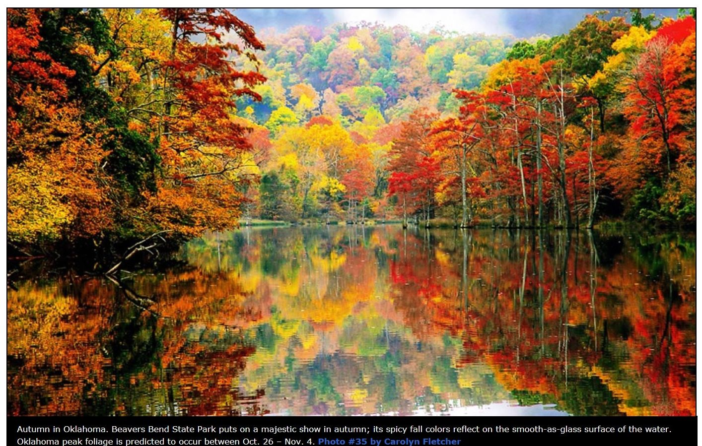
I don’t know how accurate the prediction is this year, but right now is supposed to be the best time to see the fall foliage in Eastern Oklahoma. The following photo is Beavers Bend.
https://oklahomahistory.net/ttphotos13a/BeaversBendFoliage.jpg
To see photos of the fall foliage in the 48 lower states Click Here.
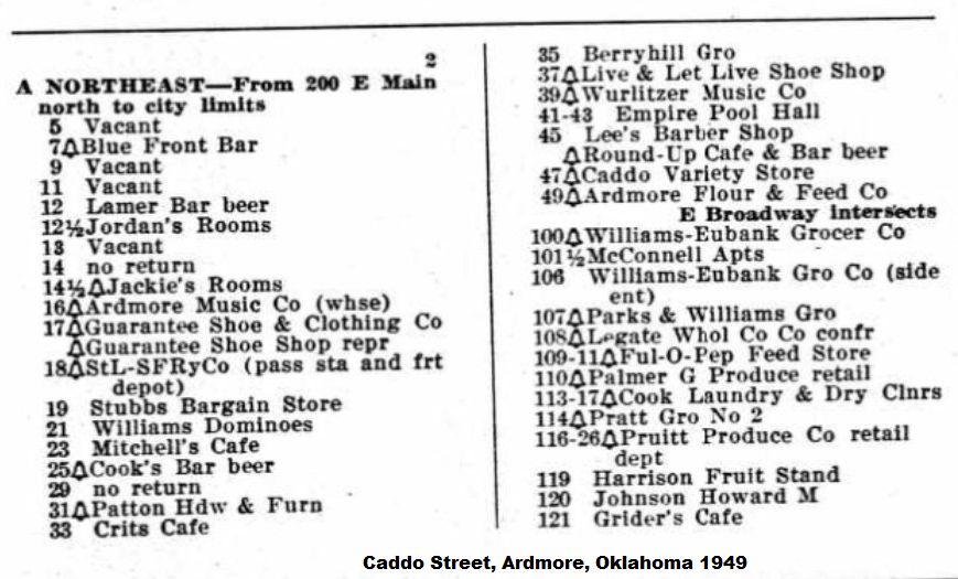
List of 1949 bars and other businesses on Caddo Street in Ardmore
https://oklahomahistory.net/ttphotos13a/Caddo1949.jpg
I’ve been sandblasting several bricks for OG&E retirees. The bricks and the OGE logo look nice. This one is for John Beck who worked from OGE after 38 years. That’s a long time.
https://oklahomahistory.net/bricks/JohnBeckBrick.jpg
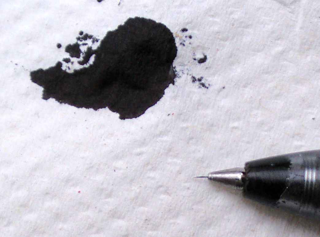
All my life I’ve been reaching for my ball point pen in the shirt pocket and the worst thing that has happened is to find it leaked ink on my shirt. But this week it was a little different. I pulled my pen from my shirt pocket, and instantly noticed a big blob of black ink at the end of it. No ink was on my shirt, but that was not all. I wiped the leaking ink from my pen and noticed a tiny, almost hair like thin piece of metal sticking out from the end of the pen. Strange.
https://oklahomahistory.net/ttphotos13a/BallPointPen1.jpg
With the ice and cold snap last weekend, Jill thought it was time for pancakes. Yummy.
https://oklahomahistory.net/ttphotos13a/pancakes112413.jpg
And now I’m saving the best for last:
Recently the Oklahoma Historical Society uploaded to Youtube the video archives from WKY/KTVY/KFOR TV in Oklahoma City. It’s a collection dating back to the early 1950s when the TV station first began broadcasting newscasts using 16mm film. I can already see I am going to spend many hours perusing through this unbelievable archive of Oklahoma history.
http://www.youtube.com/user/kforarchives
Q. What famous baseball player was born in Spavinaw, Oklahoma?
A. Mickey Mantle, October 20, 1931
Q. What color was the field of the Oklahoma State flag designed in 1911?
A. (answer in next week’s T&T)
From This and That newsletter archives of November 27, 1999:
Just a few blocks north of the old Ardmore High School, 3rd and North Washington, an owl has taken up residence in a friend’s backyard. The owl has been there over a month. Now keep in mind this is in the middle of downtown Ardmore! I sure would like to get a photo of this hoot owl, but I don’t have a camera that will take a good night shot. Hint.
—————————————————-
SmartSum is a talking calculator and adding machine that can replace your Windows calculator. Any entries are spoken out, along with any calculation results. SmartSum has a scrollable “tally roll”, which is similar to a rolling tape. You can go back and make changes to any entry, add comments, and even insert and delete entries. Calculations can be saved and re-loaded and you can even create your own macros. Other features include: the ability to check off entries, automatic sales tax calculations, ten memory locations, and the ability to replace the digit vocalization with your own sound files.
http://www.brothersoft.com/x2net-smartsum-143093.html
—————————————————-
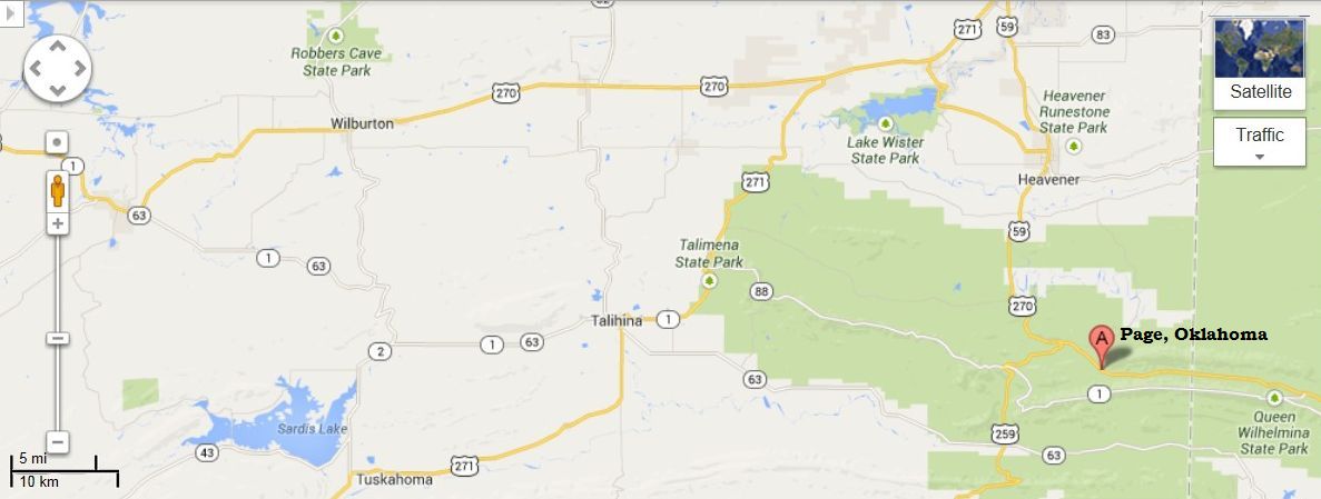
“Butch, I was just wondering if you or anyone of your readers might know anything about Page, Oklahoma. Town History? How the town got its name? Anything along those lines. My grandpa was from Oklahoma, and my Great Grandparents lived there all their lives. Their name was Page. I know there is probably no relation between them and the town but I was just kinda curious
https://oklahomahistory.net/maps/PageOklahomaMap.jpg
—————————————————-
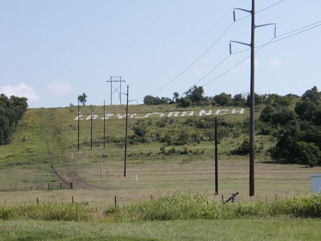
When I was growing up, 1940’s early 1950’s, the sign on the side of the mountain north of Springer read “Moss Patterson —- Lazy S Ranch.”
https://oklahomahistory.net/ttphotos/lazys3.jpg
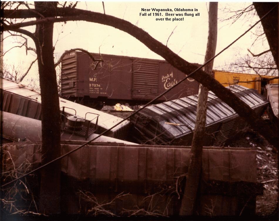
—————————————————-“Talk about memorable times. And the big train wreck in Wapanucka. I was a freshman at Murray A&M (now Murray State) at the time. A friend of mine (now my brother-in-law) and I went over there. Beat the authorities, loaded up his 55 chevy with cases and cases of Texas Schlitz beer. Hid most of it in the woods on my dad’s farm northwest of Milburn, carried some of it back to the dorm, and PARTY time. A couple of weeks later, we went back to our hiding place to get more beer, and found a couple of squirrel hunters sitting on our stash, having a good and drunken time. So, this weeks column has brought back some memories, and a couple of chuckles. Thanks Butch.”
—————————————————-
“Say whoa!!!!! I loved the map on the area you had up ,but for some reason I was not able to download it (print) it out. Sure brought back some fond memories. In fact I could have added a small road or lane in the Meadowbrook area that was not on that map. Also my father took us down to “Blue Lake” which I remember being south or so of Thackerville. Had the national guard down killing water moccasins (snakes) in the lake as they were so bad they would get into the house of the family that lived there. Had thought about buying that place untill we heard of the snakes being so terrible. I first began reading your site when my brothers ,who still live in Okla were forwarding it to me and have enjoyed it ever since……”
—————————————————-
“Hi Butch, I have read in some of the recent T&T s about the building in which Dr. Hardy had his first hospital. It not only is historic in that respect, but also for another reason… in the basement of that same building there was an establishment named The Dew Drop Inn.”
—————————————————-
“A black panther has been spotted in the Indianola, Oklahoma area, (Pittsburg Co.) by deer hunters. A couple of horses were killed sometime ago and a possibility by the panther.”
—————————————————-
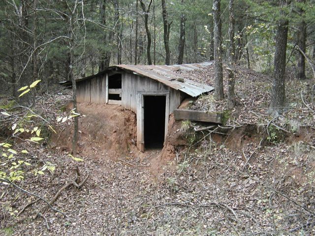
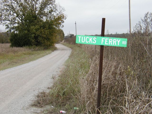
“howdy butch , hope lifes treatin’ you well. i can remember when i was a kid (probably around 7-10) my parents and my aunt and uncle took us kids and we all camped on red river right at the tucks ferry for a couple of weeks. it was kinda hard to get to then but i still remember the dugout for the ferry guy . i always thought it was a very interesting place. thinkin’ about people crossing on them in the old days.”
—————————————————-
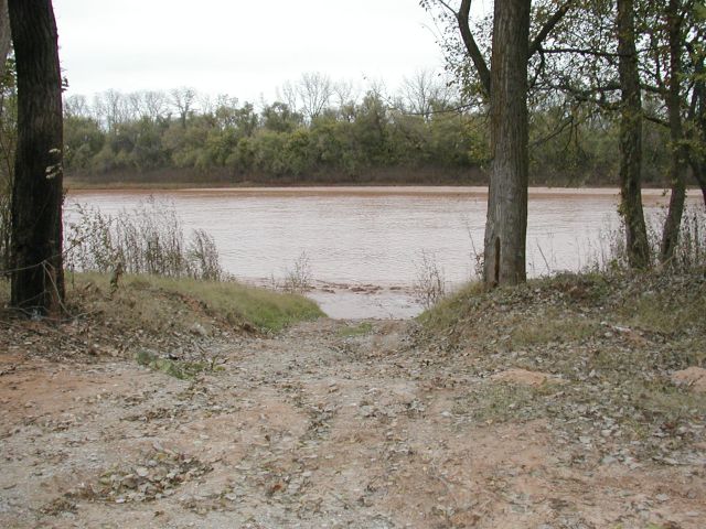
“Butch, I was originally from Marietta but now live in Texas. My grandparents had a farm in Loves Valley when I was growing up. It was across the fields from the Don McMeans near what is now called the “Hog Pen”, which is the area where the old Love Mansion & cemetery were located. I was at the old Tuck’s ferry site on occasion when I was very young and spent many, many hours fishing there before I moved in 2000. I noticed a few minor discrepancies. I assumed someone with a better memory than mine would send a correction but only noted a person saying he would use your map to get there. He will find that the road, after entering the hunting area, does not continue straight south as depicted on your map. It has 4 curves that take you southwesterly from the first curve, so you come out approximately due west of the “PUBLIC HUNTING” notation. The river runs NW to SE at that point. Also the present road was not the original access road which was the road to the west of the “13” on your map and is now closed to the public. Also the site of the ferry was northwest of the old dugout you pictured. I wasn’t aware that the dugout had anything to do with the ferry. The cut to the river that you pictured was done in the late 1990s by an agency doing research on why the alligator gars were decreasing. If you go up river from there to the end of the road you will be approximately where the ferry was located. The ferry cable ran from up the hill across the river to the Texas side. It stayed for some time after the ferry closed and the pulley and rope that were left provided a thrilling ride across the river if you had the energy to climb the hill with it. The Tuck’s also ran a restaurant in Marietta. I don’t know when the ferry ceased operation but probably after Mr. Tuck was shot and killed, in his restaurant, by an acquaintance. If you are really interested you might try to contact Bill Thompson in Marietta. As I recall the surrounding area was part of the Thompson ranch when the ferry was operating.” -David Roberson
https://oklahomahistory.net/ttphotos4a/TucksFerry4a.jpg
https://oklahomahistory.net/ttphotos4a/TucksFerryRiver.jpg
https://oklahomahistory.net/ttphotos4a/TucksFerryRoad.jpg
GPS: copy and past the following in Google Maps- N33? 51.148′ w 097? 03.015′
—————————————————-
“Hello Butch: Adam Jimmy or Adam’s Jimmy was a horse and mule trader during the late middle and later part of the 1800’s. He traded mostly with the Army and was kind of a hermit. He was not married and lived in a small log cabin that was small and had a pole in the center holding up the roof. He lived first in a dugout until his cabin was finished. The dugout is about ten feet from the north side of his cabin. The open prairie area north of Overbrook, Oklahoma was known as Adam’s Jimmy prairie. His cabin was on the west side of that prairie on the ridge that runs along the west side. The cabin is gone and nothing remains that shows one was ever there. However, I know the exact spot where the cabin and dugout were located. Adam’s Jimmy did not retire to the Hot Springs, Arkansas area as most people believe. He died in a drunken brawl when his skull was split with a brass stirrup and was buried in the Oil Springs Cemetery there in Love County.”
—————————————————-
Gas prices today in the Ardmore area……
http://www.oklahomagasprices.com/index.aspx?mss=152754
Check gas prices by town or zip code anywhere in U.S.
http://www.kmov.com/traffic/gas-buddy
Non-ethanol gas (pure gas) stations in the Ardmore area (updated).
https://oklahomahistory.net/puregas.html
Some mail from this week’s MAILBAG…..
Springer Christmas Parade ? Saturday ? December 14, 2013
Open to antique cars, bikes, ATV, floats, walkers and horse groups. Entry fee is one new unwrapped toy. If you want to participate in the parade, please meet in the Springer School parking lot on the South side of the school at 12:30 PM and the parade will start at 1:00 PM. Volunteers are welcome and greatly appreciated. Come and enjoy the parade and join everyone at the Community Center for refreshments after the parade.
“Butch, I wanted to say thanks again for your newsletter. I missed it last week and had to look it up. I’m so glad I did because I found the story about the Magnetic Mountain. I think all of us Southern Oklahoma people have “coasted” up the hill. I sent the video to my daughter in Florida so she could remember the special things from home. Thanks again!!” -Rose Lack Chaney
COMING TO THE WASHINGTON THEATRE ON TUESDAY, DECEMBER 3, 2013
“Asleep At The Wheel”
Santa Love to Boogie
Call the Goddard Center at
580-226-0909 for tickets!
http://www.WashingtonTheatreOK.com
“I was a student at Southeastern when the Wapanuka train wreck occurred. We heard of the beer (Texas 6 point) and headed north. We arrived at the sight and wondered why there was so much mud sense it hadn’t rained for months. We were wading in beer mud. There were armed guards in the area and we were sore afraid. Seems they were guarding the appliances in the cars, washing machines, refrigerators, etc. We started hauling beer cases and they could care less. A 1955 Chevrolet trunk can hold 24 cases of Schlitz tall boys, believe me. Fun times when ur a foolish college student.” -George AHS class 1960
“Great article Butch. Couple comments. Re: Milburn lights, north and west of Milburn near bold springs. If memory is working, it was phosphorus gas escaping from the ground, and when hit by moonlight gave an eerie glow. And the train wreck. I was a freshman at MSC. A friend and I were able to load up a bunch of beer in his car, took it to my dad’s farm and hid it in a ravine in the pasture. This was Texas 6 point beer. Party time at the dorm. Wish I knew who the writer from Healdton was. Lol
Keep up the good work.” -Jerry
We were particularly interested in “Warren’s Trading Post” since one source stated that it was “near” Col. James Bourland’s House and another source stated that it was “about 11 miles west” and yes, the “Warren’s Trading Post on your map is about 11 miles west. So that’s the main reason I included this map in my book.
I enjoy reading your newsletter every Thursday night. I suspect you’ve published that newsletter for about 15 yrs. The citizens of Ardmore and environs are lucky to have you as a friend.
Patricia Adkins-Rochette, 580-252-2094
1509 Shadybrook Lane
Duncan, OK 73533 http://www.BourlandCivilWar.com
BOURLAND IN NORTH TEXAS AND INDIAN TERRITORY DURING THE CIVIL WAR: FORT COBB, FORT ARBUCKLE, AND THE WICHITA MOUNTAINS
https://oklahomahistory.net/ttphotos13a/pp294-295CivilWarTimelineSept.pdf
“Tis the season to sing! With a concert event titled “Comfort & Joy”, Southern Oklahoma’s Community Chorale brings this holiday season to life. The chorale, directed by Dr. David Hobbs and accompanied by Diane Boland, will present an eclectic blend of Christmas favorites from selections from Handel’s Messiah to traditional carols. This year the Chorale will be accompanied by strings, harp, and unique percussion featuring marimba, vibraphone, steel drums, and much more. As always, we strive to include something for every musical taste – a little of this and a little of that. If our concert were a painting, we could say “we paint with many colors – very vibrant”.
This year’s event will be Friday evening, December 6th at 7:30 p.m. and Sunday afternoon, December 8th, at 2:30 p.m. Both at Northwest Baptist Church, 1609 Robison in Ardmore. Tickets are $10.00 and will be available at the door.
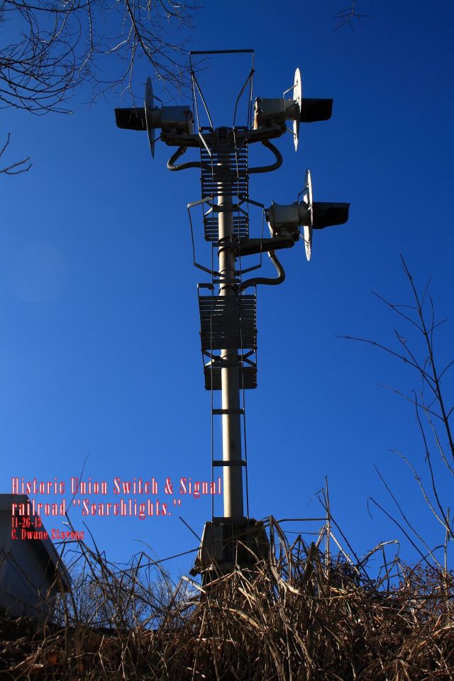
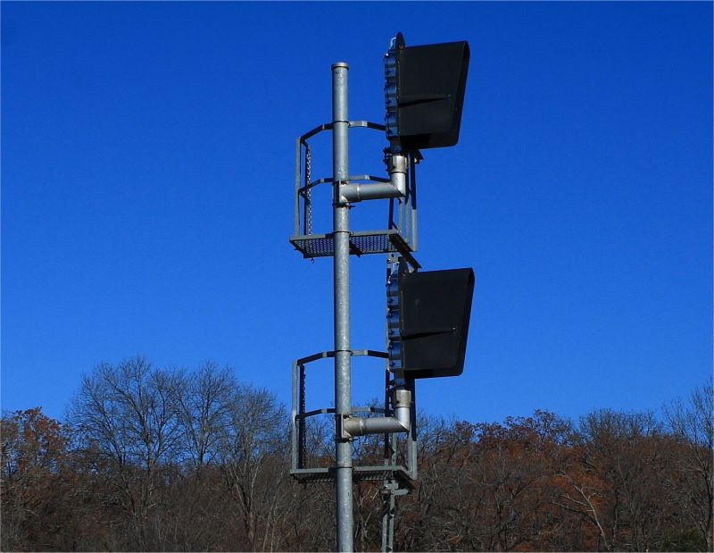
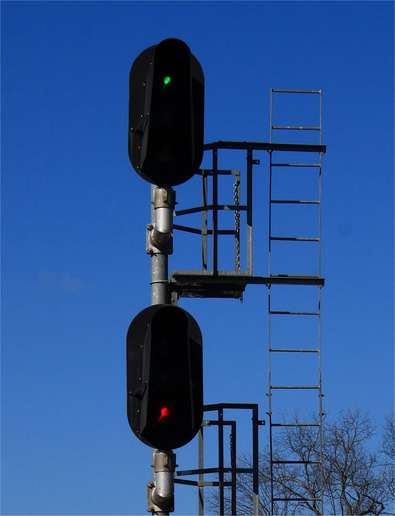
“Hi Butch, I made that video “cartoon like” mostly for my rail buddies but actually the signals in the background are now quite rare and old (even older than the frozen old man, LOL).
These historic US&S (Union Switch and Signal) railroad signals, commonly called “searchlights,” have been in use on railroad lines in the US for many decades and the company itself dates back to 1881.
They are not crossing signals but are called “block signals” and are displayed down the track to the engineer so that he knows if the next block ahead is clear. Different rail lines use slightly different indications but basically a green display means the next block ahead is clear, red means the next block is occupied-stop immediately and yellow (amber) means the “second” block ahead is occupied-be prepared to stop. Occasionally you can see a flashing amber signal as well which can have different meanings depending on the rail line. Each block is typically about 3 miles long.
Several years back the railroads began replacing these old traditional searchlights with what’s called the modern “Hooded Signal Head.” The new style is much easier to maintain and is therefore preferred by the railroads. However, by far the majority of rail photographers prefer the old traditional searchlight style as opposed to the new hooded style and they have been trying to photograph as many of the old historic searchlights as they can.
Seems the Ardmore area has some of the very last ones remaining on the Burlington Northern Santa Fe system nation wide. I have been receiving emails from photographers from several states wanting directions to the few that are still in regular operation here after they saw some of the videos and photos I have posted. Even the ones we have are disappearing fast so everyone is scrambling to get shots of them. Several photographers are planning to come to Ardmore during the holidays to get shots of our historic searchlights.
We also have “one” example of what has become an even more rare type of these searchlights. It’s a triple searchlight combination mounted on a single mast and is located between Ardmore and Marietta, Okla. Engineers and Conductors generally don’t like this type since they can be a bit confusing depending upon the direction the train is approaching it from as well as day, night and weather conditions. However, since these are especially rare today rail photographers are grabbing as many shots as they can. Again, the Ardmore area is especially fortunate (for rail historians that is) to have “one” of these still operating, at least for the present.
I have attached a photo of the rare Triple Searchlight in our area and two photos of the modern “Hooded Signal Head” type that is going up across the country. The “hooded signal heads” are ugly aren’t they.
The old searchlight signals have one light source inside and three colored lenses which move in front of the light beam to change the color from green to red to amber whereas the new style has three separate lights in the housing, one green light, one amber light and one red light.
There are many different types of signals that have been used across the US and even though these “Searchlight” may not be as elegant as some of those once used back east they are still historic and very
rare.” -Dwane Stevens
https://oklahomahistory.net/ttphotos13a/TripleSearchlight112613a.jpg
https://oklahomahistory.net/ttphotos13a/Searchlight112613a.jpg
https://oklahomahistory.net/ttphotos13a/Searchlight112613b.jpg
The Daily Ardmoreite – February 10, 1947
Tahlequah, Feb. 10 – E. D. (Daddy) Hicks, 80-year-old Cherokee Indian who built the first telephone line in what is now Oklahoma in 1886, died at his home Sunday. He recalled that the Cherokees opposed his project for establishing Indian Territory’s first telephone service until he convinced them the mysterious boxes could “talk Indian” as well as English. Hicks and two partners set up the service between Tahlequah, Fort Gibson and Muskogee. He and Judge William P. Thompson installed a telephone exchange here in 1896, starting with 18 subscribers. The company later was sold to the Southwestern Bell Telephone company and he was district manager for the company here for 28 years before he retired in 1934. Survivors include his widow, Mrs. Elizabeth Hicks, two daughters and two sons.
Since Thanksgiving fell on a Thursday I usually send out my newsletter, I decided to send it out a day early this year. I hope everyone enjoys this Thanksgiving with family and friends, no matter where you are, stop for a moment to give thanks for all the good things God provides.
We Gather Together – 1597
We gather together to ask the Lord?s blessing;
He chastens and hastens His will to make known.
The wicked oppressing now cease from distressing.
Sing praises to His Name; He forgets not His own.
Beside us to guide us, our God with us joining,
Ordaining, maintaining His kingdom divine;
So from the beginning the fight we were winning;
Thou, Lord, were at our side, all glory be Thine!
We all do extol Thee, Thou Leader triumphant,
And pray that Thou still our Defender will be.
Let Thy congregation escape tribulation;
Thy Name be ever praised! O Lord, make us free!
See everyone next week!
Butch and Jill Bridges
Ardmore Oklahoma
PO Box 2
Lone Grove, Oklahoma 73443

Carter County Courthouse Paver Project
http://www.brightok.net/cartercounty/pavers
Save on long distance calls, just a couple cents a minute!
http://www.CheapLongDistance.org
Ardmore High School Criterions Online
http://www.ArdmoreCriterion.com/
Oklahoma Bells: https://oklahomahistory.net/bellpage.html
American Flyers Memorial Fund – Administration Webpage
https://oklahomahistory.net/crash66.html
Official American Flyers Memorial Website
http://www.brightok.net/~wwwafm
Ardmore Army Air Field/Ardmore Air Force Base Website
http://www.brightok.net/~gsimmons
Mirror Site of the Ardmore Army Air Field/Ardmore Air Force Website
https://oklahomahistory.net/airbase/
Carter county schools, past and present
http://community.webshots.com/user/oklahomahistory
Carter County Government Website
http://www.brightok.net/cartercounty/
All previous issues of This & That can be found on my Website.
Feel free to forward this free newsletter. Mailouts: over 1,600.
To be removed from my T&T mailings, just send me an email.
I do not sell, trade or give my mailing list to anyone for any reason.