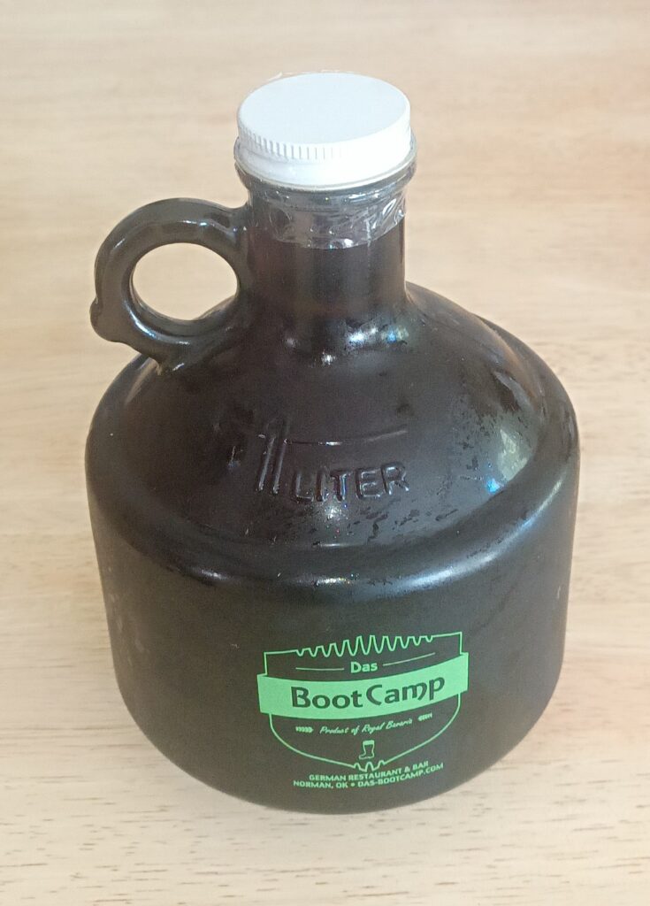
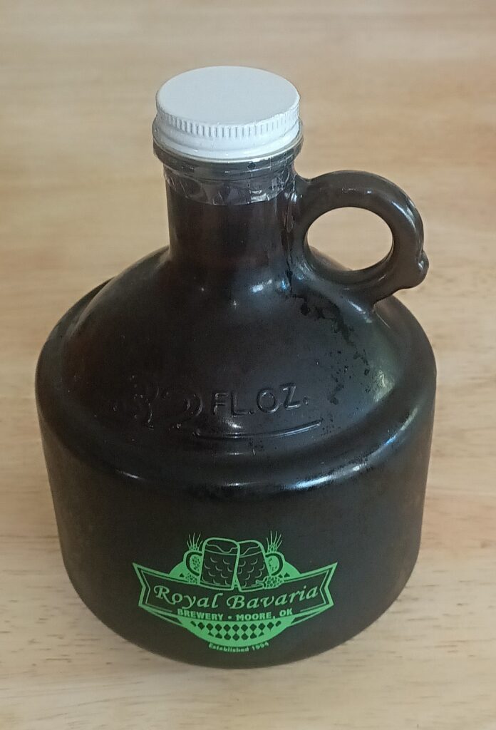
I had a surprise visitor this morning. My neighbor, Vana Williams, broght me a jug of real German beer. I need to take everyone back to April 2007 when Jill and I went to the GermanFest at Muenster, Texas. I wanted to try some authentic imported German beer but there was none to be found at the GermanFest (go figure). Anyway, Vana recalled this 2007 incident in my newsletter when I told about the let-down of not getting imported German beer at the Muenster GermanFest.
Vana was eating at the Das Boot Camp German restaurant in Norman yesterday and brought back with him a jug (called a growler) of German beer for us to try. He said the key is serving it in ice cold glasses, so Jill put two glasses in the freezer in preperation for the opening celebration. We can hardly wait.
“Friends Make Life Worth Living”
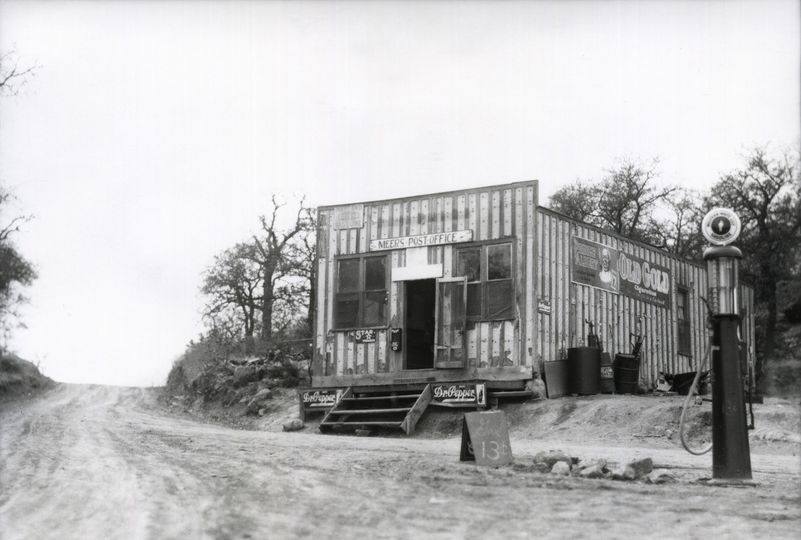
Meers, OKlahoma 1900
Nothing beats cooking with a cast iron skillet. Does your cast iron skillet have a sticky film? Here’s how to remedy that problem.
https://www.youtube.com/watch?v=rRZMXZfcol8
Cowboy Kent Robbins has a lot more cooking the cowboy way on Youtube. Check out all his videos on his Channel at the link below.
https://www.youtube.com/@CowboyKentRollins
From this week’s Mailbag
Hey there “On-The-Halves” > For some reason the article on the Elmer,
Ok general store can’t be viewed. When you click on your ‘click here’
icon, the screen goes blank. The same thing happened when I tried
viewing the article online. Perhaps you could pull up the article,
print it, and send it to my email address. That’s the only T&T blue
app icon that doesn’t work in your 1450 issue. Could be an issue with
this old Mac of mine > strange though, that I can’t pull up this
article. – Steve
Note: Here is the link again.
https://www.onlyinyourstate.com/experiences/oklahoma/delightful-general-store-ok
Dr Hardy signed the live birth certificate for old what’s his name out in Vegas when he was born on the 9th of January 1942. Who could have imagined that three years and twelve days later Dad would be listed as KIA. I was almost 25 months old and old what’s his name out in Vegas had just turned 36 months old.
If my memory serves me right and it’s usually pretty spot on. I believe that it was Mrs Hardy who ran the stop sign when I had the green light going west to Ponder’s that caused the accident almost totalling the front end of my brand new 64 Ford Galaxy 500 just after the 1st of January. I only had the car for ten days. -Ralph Ford (Poss)
HAM Talk by KC5JVT via Echolink
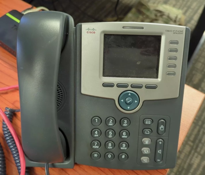
I’ve ordered me a refurbished Cisco SPA 525G IP (VOIP) Phone (and power supply). I’m going to set it up on my home network to communicate with other HAMs all over the world through the internet. This model has the color screen and will wirelessly connect to my home Router (no Ethernet cable needed). Hamshack is the HAM radio “Bat Phone”. No HAM radio needed and its FREE, but you still have to be a licensed HAM. I read about 8 to 10,000 HAMs worldwide use the HamShack Hotlaline network.
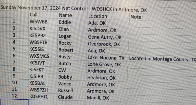
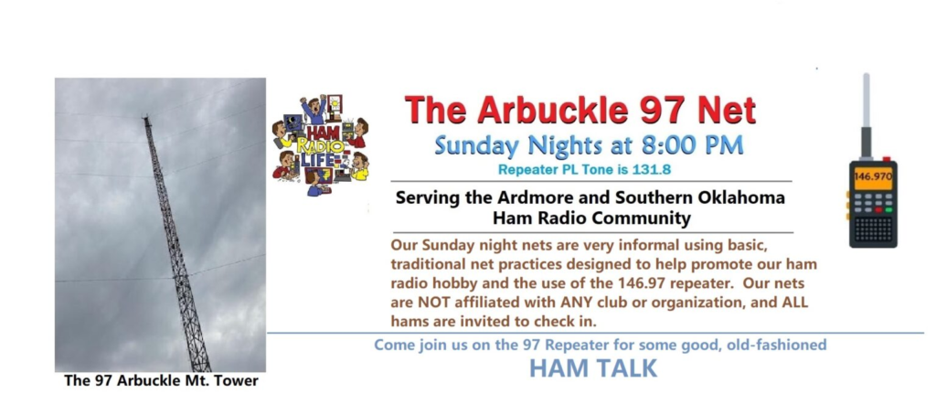
Below is the check-in roster for last Sunday at 8:00pm on the Arbuckle 97 Net.

Below is from my newsletter archives dated
February 1, 2007 – Issue 523
What used to be the world’s longest conveyor belt at Ada, Oklahoma maybe still be in use, at least to some extent, as it snakes its way south from Ada. I took a couple of pics, one even has the locomotive engine just entering the picture. Now that would happen again, unplanned, in 50 years.
https://oklahomahistory.net/ttphotos7a/AdaConveyorBelt7a.jpg
https://oklahomahistory.net/ttphotos7a/AdaConveyorBelt7b.jpg
Jack Blackwood sent in a photo this week he took of an old outhouse at Russett, Oklahoma. Its located just as you start into Russett from the south on the east side of Highway 1. Russett is in Johnston county.
https://oklahomahistory.net/ttphotos7a/OuthouseRussett7a.jpg
“Butch, In reference to the radio towers on Davis mountain. The smallest and furtherest to the left is a tower owned by the Oklahoma Wildlife Department. When we built the new one, behind and just ever so slightly to the right of the second tower in the picture, we abandoned the old tower to the land owner at that time, Fred Chapman. Fred rented some space on the tower to various entities, but it appears to be empty now. The new Wildlife Department tower is 400′ tall, which is twice as tall as the old one, 200′. Several of the towers are new since I was last up there. One belonged at one time to AT&T, there are a couple of cell phone and Microwave towers. On a clear day, you can see OKC from the top of the mountain. It was a line of sight shot from this tower to our OKC tower, located at the 600′ level of the KWTV tower on North Kelley in OKC. Few know that the KWTV tower has an elevator that goes up to the 600′ level. It is a scary and squeaky ride to that level on an outside elevator, up a swaying 1,500’+ tower. I have made that ride several times, but I don’t think I will ride that elevator again or climb the tower at Davis mountain again. A funny story: When we started to build the new tower, Ed Wolford, our Radio Division Supervisor, Bob Mullenix, Game Warden from Marietta and myself showed up to do the work. Ed brought a pick and two shovels. I hit that solid rock of a mountain one time with the pick and it didn’t even chip it. We went back to town, rented an air compressor, jack hammer, back hoe and bought a case of dynamite. After much drilling, blasting and scooping, we got a hole big enough to pour a base for the tower. We hired a tower building company out of OKC to construct the tower. After we got it built, it turned out to be right in the path of the AT&T tower and caused a problem with telephone signals, so we had to tear it all down and build it again, 25′ further west. All in a day’s work.” -Lt. Rome Ingle (ret) Oklahoma Department of Wildlife Conservation
“Cuz, Those towers in the Arbuckle Mountains you mentioned were installed by the TV Stations in Oklahoma city (WKY TV – Channel 4 took the lead) as relay towers in order to transmit their signals over the Arbuckle Mountains to Ardmore and other towns and cities south of the Arbuckles. I believe they were actually put in in the mid to late 40’s but don’t hold me to the dates – just that when my Step-Dad Ford was working as a “Cub-Reporter” for WKY TV – (he use to film events in the area for broadcast on TV with eight and sixteen mm cameras) he told us that was where we received our TV signals from and in the early stages of outside TV antennas, everyone pointed their antennas towards those towers.” -Poss
Kirk H. Smith in Montana sent this email:”Butch, First, thanks to everyone for sending me all the great variations on frying Okra. Also, hate to correct you, but I did not grow up on Tater Hill, but my mother was born there in 1915 as was my grandfather about 1893. My grandfather was killed there in a horse accident coming down the south side of the hill. His father moved there and built the homestead from Mississippi. I spent a lot of summers around there runnin around with my cousins, and went up there in the late 60’s with my mother and aunt to see the remains of the old homestead and cellar, which was still there. we also found the old little family cemetery which was down on the east side of the hill. I was back there in 2002 and about where the cemetery was , now there is a road running north-south and a mobile home. Heres a pic of the Hill looking west from that road. The homestead was up on the top over on the north side.”
I was born and raised in Ardmore. This week I learned that located just 3 or so miles east of Ardmore, just a couple of miles from where I grew up, is a place called Long Mountain. Long Mountain is just a little to the north of Tater Hill and not as high. Tater Hill is 1,032 feet. As soon as warmer weather gets here, we’ll make a trip to these two places and get some pics, along with a GPS reading for Long Mountain. Now the next question is how did this spot in eastern Carter county get the name Long Mountain?
I only lived in Ardmore eight years but feel close to that community. The elevation of Tater Hill is approximately 1032 feet. The center contour of the ring on the topography map is the 1030 foot contour… I’ve attached a larger view of this contour map along with a photo of the same area… This topo map and photo is taken from the following website.

Here’s the website on the photo above.
Download “USAPhotoMaps 2.76″… I’ve used this website
for several years…A few pointers, if I may…
* Press T on keyboard for topography maps of an area
* Press P on keyboard for aerial photo of an area
* Press + on keypad to zoom in
* Press – on keypad to zoom out
Time to learn to use the above software is about 15 minutes if you are a fast learner…Very useful free software. Let me know if I can help with it. You’re doing good. Keep it up.” -John Key
“The cabin that you referred to in your article is actually on Long Mountain, not Tator Hill. Long Mountain is just North of Tator Hill and we are the new owners of the cabin. Tator Hill is owned by Nora Harris, and there is not a road to get to the top of it (quite a hike). We are not sure if Long Mountain is the highest elevation (that one can drive up on) in Carter County; but we would like to know, if someone has a GPS. On a clear day, you can see the water on Lake Texoma. Storm spotters use Long Mountain to watch for severe weather. There is a marker up on Long Mountain that we are told the whole County was surveyed from in 1936. Fourth of July is spectacular up here. You can see all the fireworks shows in Southern Oklahoma. The whole horizon is lit up with fireworks. Last fourth of July was open to the public. Folks were welcome to bring chairs and blankets to enjoy the many shows. We are hoping to be able to do it again this year.” -Anna
“Butch, When I went there in the late 60’s, we went from the road (Tater Hill Road ) and walked north straight up and over the top of the hill. Mom showed me the foundation of the old homestead and the cellar which was still there. It was just north of the top of the hill. Then we walked down to the east and a little back south down the hill to a small bunch of trees. In there was a little cemetery with one of those old fashioned iron fences around it with a little ladder that went up and over the fence. There were , I dont know for sure, maybe 5-10 graves in there with stones. The picture I sent you , on the left about halfway up the hill is a little clump of trees that might be it or it may be further north, or is under the road there now or the mobile home yard, but I think it was on the side of the hill about halfway down in a group of trees. Sure would like to walk around there with a metal detector……..Yep, 3 generations of my family were born and lived there. My mom was born in the cellar, because it was cool in there. She used to walk to the ( Dinky ? ) and ride into town. My grandpa was buried in Providence (sp?) cemetery, and I think my grandmother was buried across the road from there in another cemetery because grandpa was buried with some kinda mens org. and they didnt bury women there or something like that. My bunch of cousins all still live within a few miles or less of Tater Hill. I met a lady through T&T whose grandparents were good friends with mine and were there when he was killed thrown from the horse. Just replying to you with some fuzzy facts.” -Kirk
“Once I traveled about in an old bakery wagon, double-doored rattler with a mattress on the floor, I stopped where people stopped or gathered, I listened and looked and felt, and in the process had a picture of my country the accuracy of which was impaired only by my own shortcomings.” –George Steinbeck
Butch and Jill Bridges
Ardmore, Oklahoma
580-490-6823

